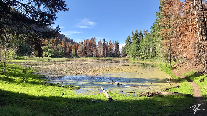
Red Lake in Payson Canyon
Red Lake in Payson Canyon

Red Lake is a small almost pond with a depth of about four feet
Red Lake is located southwest of Maple Lake (due west of Dry Lake Reservoir) just off the Nebo Scenic Loop in Payson Canyon, Utah.
Getting to Red Lake
There are three common routes to Red Lake.
- The shortest and most common route directly from the Maple Lake parking lot near the restrooms.
- A slightly longer route starts near the second turn in the road up hill from the Maple Bench Campground on the way to Maple Lake (0.5 miles from the Nebo Loop turn off, 0.2 miles from the Maple Bench Campground).
- The longest route starts near the bottom of Payson Canyon close to the corrals and where the natural gas facility is.

Maple Lake Route
This route is the shortest and has the most available parking. Expect to pay the "day use fee."
- The trail starts off west through a grove of maple trees and before turning south, heading downhill rather quickly before crossing Right Fork Peteetneet Creek.
- About halfway to the bottom, it joins the Maple Bench route—coming from the north.
- After crossing the creek, it continues south before it makes a U-turn north along the gas line.
- Before climbing the big hill in front of you, the trail turns west and then north before joining the Gas Line route—coming from the northeast.
- As the trail turns south there will be a couple wide switchbacks before heading south and plateauing out at Red Lake.
Just after the trail leaves the gas line and heads west, there's a rusted out old truck near a very small meadow on the north side of the trail where we've stopped for photos before.
Once arriving at Red Lake, I've usually headed east on the north side of the lake to a camping area in the northeast corner. If that site is not available, or the group prefers to, we head south along the east side of the lake to the southeast end to a much larger camping area.
There is a really good view down into Utah Valley if you head a very short distance northeast from the dam.
2018 FIRE UPDATE: I highly discourage using the campsite on the south end of the lake due to all of the dead trees that will eventually fall. The north campsite is mostly still usable. Just keep your distance from any dead trees.
In low water years, the best place to filter water is the stream near the east side of the dam on the north end of the lake. A pre-filter is highly recommended as the can be a lot of suspended sediment in the water, especially if you filter from the lake itself.
Maple Bench Route
The route starts about a half mile from the turn off from Nebo Loop Road near a bend as the road is heading south. There is very limited parking on the road's shoulder. The "day use fee" is still required.
- The trail starts heading west, has a minor drop heading south, rounds a corner before heading south again. Much of the trail is on an abandoned road from when the dams of lakes were built.
- As the trail gets close to Right Fork Peteetneet Creek, it makes a turn southeast and climbs before leveling out and heading south again. A landslide has taken out the old road and trail, so you'll have to figure a way past the landslide. It seems that some have crossed the stream and then back.
- Then it joins the Maple Lake route at #2 listed on that route.
Gas Line Route
This route starts near the stables and fields near where the gas line crosses the road.
- The trail follows the gas line south and past the west side of Maple Dell Scout Camp.
- The trail eventually peels west and joins the Maple Lake route at the end of #4 on that route.
- If you miss the turn off, you can catch it at the beginning of step #4.
About Red Lake
Don't expect a pristine lake for fishing or swimming. Most times of the year, Red Lake is not much more than a very shallow and reed infested pond. But, that shouldn't deter you from wanting to visit this area of Payson Canyon. I've been there several times with scout groups wanting to have a short, easy overnight hike, a chance to build lean-tos for wilderness survival skills training, and more.
| Description | Coordinates |
|---|---|
| Nebo Loop turn off to Maple Lake | 39.962668, -111.690328 (map) |
| Maple Bench Campground | 39.96291, -111.69245 (map) |
| Maple Lake route parking | 39.955130, -111.693058 (map) |
| Maple Bench route start | 39.96114, -111.69293 (map) |
| Maple Bench route landslide | 39.95533, -111.69744 (map) |
| Gas Line route parking | 39.990539, -111.699757 (map) |
| Maple Lake/Maple Bench route junction | 39.953201, -111.697314 (map) |
| Maple Lake/Gas Line route junction | 39.950989, -111.703451 (map) |
| Red Lake | 39.946394, -111.708159 (map) |
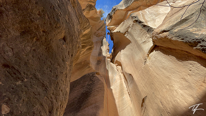
Photo Gallery


")


")