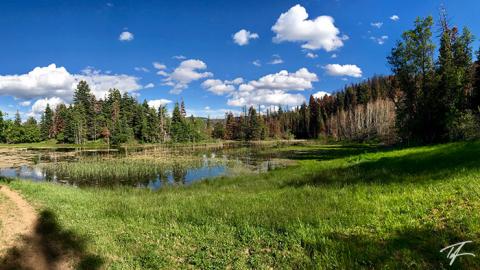
Willow Flat to Bloomington Lake
Willow Flat to Bloomington Lake
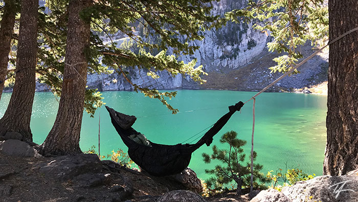
Bloomington Lake is a small alpine lake (elevation 8,200 ft/2,500m) west southwest of Paris, Idaho (on the shores of Bear Lake).
I know this was at least my third visit to Bloomington Lake.
My First Visit to Bloomington Lake
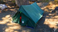
One visit, I was a little boy when my family and another family came to this lake for a multi-night trip. All I remember from that trip was that it rained... and rained... and rained. Everyone basically spent a couple days stuck in the tents except for the dads when they ventured out to attempt to cook meals for the rest of us. Why we didn't pack up and leave is beyond me. The lake is a relatively easy half-mile hike from the parking lot. My mom enjoyed camping, up until that trip.
A Tree Within a Tree
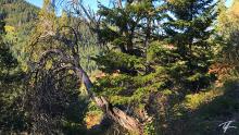
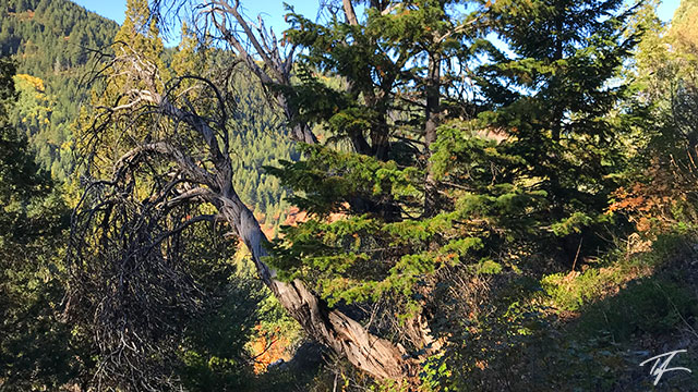
I was 14 or 15 years old. I was there with a Scout group. We camped at the lake, played on the rope swing, and a small "glacier" to the right of the cliffs. The glacier is now gone. Honestly, I don't remember what time of year we were there. It might have just been a remaining snowfield from the winter. Anyway, we had the plan to hike from Bloomington Lake down to Willow Flat on the Preston, Idaho side of the mountain. My dad, who wasn't joining us on this hike, told me about how the last time he had hiked this trail, he had seen a small tree growing out of another tree and that I should look for it. He said it would be before you get to the Cub River Spring just above Willow Flat. I found the tree on our way down just as he described. It was a fairly small tree of only a few feet tall growing out of the crook of two branches of a much larger tree.
Overdue Return
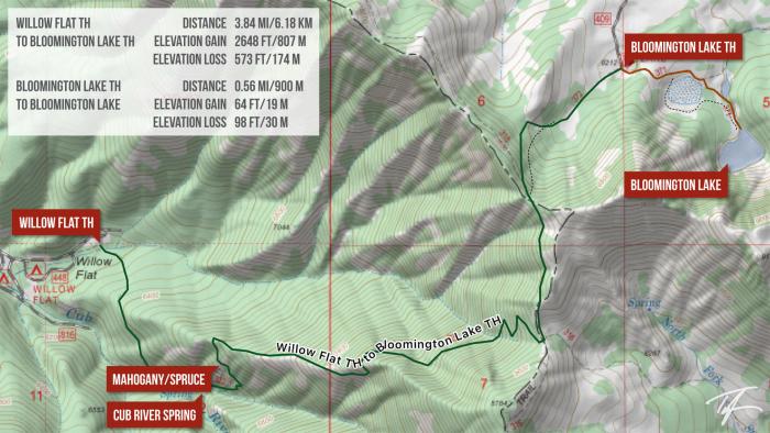
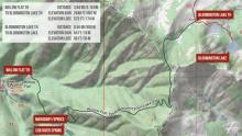
Late this summer, I suggested to my brother that we do a backpacking trip before his son leaves on his LDS mission for two years. We determined that it was long overdue that we visit Bloomington Lake again. I suggested we hike up from Willow Flat to Bloomington Lake. It would be a 3.84 mile hike from trailhead to trailhead with 2648 ft of elevation gain and 573 ft of elevation loss.
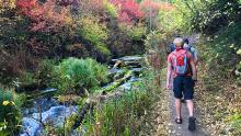
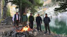
I was hiking with my brother and two of his sons while my dad drove around to the other end of our trail. The trail starts from a Forest Service campground and follows the Cub River upstream to the spring—it's headwaters. The spring is one of the biggest I've ever seen. After the spring, we somehow lost the trail, but since I have a great map app on my phone, we were able to find it after bushwhacking for a bit.
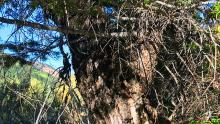
Drawing from my memory of nearly 30 years ago, I recalled the trees I saw as a Scout would be about halfway between two lower switchbacks on the downhill or left side of the trail as we hiked up. My memory served me well as I found it right away. I was shocked to see what had become of the pair. The larger host tree was now seemingly dead. It was a Mountain Mahogany that had grown to full size. The tree it hosts seems to be a Douglas Fir and has also grown to full size and is still thriving.
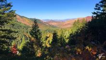
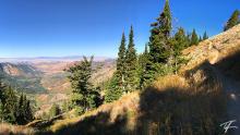
We continued to ascend up the mountain with better and better views of the valley below. Near the top of the climb, we joined the High Line Trail and continued north until we dropped northeast to the Bloomington Lake Trailhead where my father was waiting. The parking lot started filling up while we had lunch at the trailhead and then backpacked the remaining 0.56 miles to Bloomington Lake. My brother wanted to pack in one of his inflatable SUPs—rather have one of his sons do it.
The hike in is relatively easy with only a couple of short small elevation gains. Actually, the trail profile from the trailhead to the lake is 64 feet of gain, and 98 feet of loss. Bloomington Lake sits 33 feet lower than the trailhead.
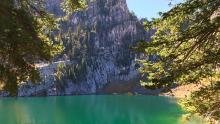
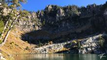
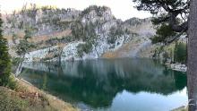
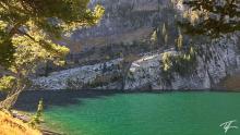
There's a small shallow unnamed pond before you arrive at Bloomington Lake. Don't be disappointed thinking that's the lake. Keep following the trail and you'll round between a couple of small hillsides as you join the stream coming out of the lake. You should start seeing the lake and cliffs surrounding it. The water in the lake is a very clear emerald green color. The cliffs at the lake's edge are beautiful! The lake sits on the north slope of a cirque, so it stays shaded until late in the morning and gets shaded early in the evening.
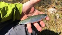
Bloomington Lake is known for its rope swing. It's had one for as long as I can remember. Its popularity was evident as we saw groups of hikers flow in one after another giving way to backpackers as the evening progressed. A very large group of Scouts came in. A few very late, and loud backpackers came in at around midnight. The next day, a Saturday, groups small and large came to enjoy the lake. I think we counted 40+ day hikers. Some were even attending a wedding in Paris, Idaho later that day. The rope swing got plenty of action! A few paddleboarded on the lake. Others hiked on the cliffs at the east end of the lake. I was one of a few fishing. In our two days, I caught 11 fish, all about palm size. None large enough to eat.
As we packed back out to the trailhead, I noticed my brother's oldest son struggling again with carrying the SUP. It hit me. I took off my 46 liter backpack and handed it to him. I put the SUP on my back and he carried my pack out on his chest—commenting that it didn't even seem that there was anything in it.
It was awesome getting back to a place that I had fond memories of. The lake didn't disappoint my childhood memories. On the contrary, it made me want to take my own family there next summer. My dad struggled a little with our short backpacking trip. Having to stop often to rest, he complained that his joints were hurting him and took several ibuprofen to ease his pain. It's sad to see him struggle with an easy hike like this. He enjoyed countless multi-day backpacking trips in the Uintas, Wind Rivers, Yellowstone, and more. He was an avid outdoorsman and I owe much of my love of the outdoors to him. He is my inspiration.
| Description | Coordinates |
|---|---|
| Willow Flat Campground Trailhead | 42.1324800, -111.6129083 (map) |
| Cub River Spring | 42.132580, -111.612850 (map) |
| Mahogany/Spruce | 42.1338200, -111.6116167 (map) |
| Blloomington Lake Trailhead | 42.149351, -111.583554 (map) |
| Bloomington Lake | 42.144782, -111.576077 (map) |
