50 Miles of Yellowstone's Cascade Corner
50 Miles of Yellowstone's Cascade Corner
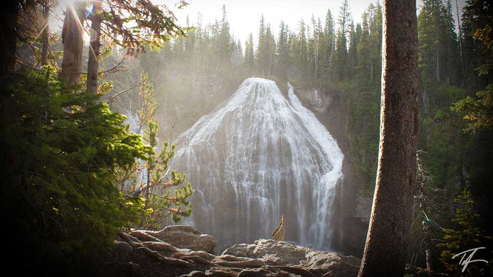
I had the privilege of planning and guiding 13 young men and adults through 50 miles of the Bechler region of Yellowstone National Park, often referred to as the Cascade Corner. I was responsible for arranging for food, permits, and route planning for each day.
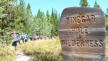
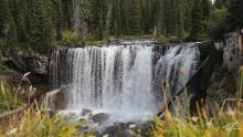
Picking up our permit at the Bechler Ranger Station put us on a later start than we would have preferred. We hit the trail late Monday morning at the Fish Lake trailhead just off the Grassy Lake Road (Ashton-Flagg Ranch Road). Over the course of our five day hike, we planned on seeing seven waterfalls and crossing eight river fords—you can see why it's called the Cascade Corner.
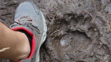
Look, Bear Tracks!
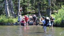
Monday was just over six miles to campsites 9U4 and 9U5 (we had to have two each night as they are limited to 8 per site). It was a long hard push considering our late start for the day. We had three river fords. We found fresh bear tracks right on the trail between the log crossing over Mountain Ash Creek near 9U4 and the ranger's cabin. We never did see the bear. We were supposed to hike to Union Falls and Ouzel Pool, but the boys were exhausted from our first day.
Filter Failure!
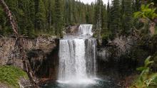
A few of us decided to see the sunrise at Union Falls Tuesday morning (our first Cascade Corner waterfall) before hiking our planned route for the day. It was well worth it! Once we joined up with the rest of the group, we headed west on the Mountain Ash Creek Trail and then up the Bechler River Trail to 9B2 and 9B4 for the night. About 2/3rds of the way between 9U1 and the junction with the Bechler River Trail, we stopped for lunch at a stream and beaver pond. While there, we filtered water for the group. Later that day, we discovered that was a huge mistake! When we arrived at 9B2 and tried to filter water again, we discovered that both of our filters were failing due to the murky waters of the pond. Two of us had brought pump filters for the group and now we were in a position where we were hobbling by at about 20% of normal and getting worse.
We also had an adult that was struggling due to his inability to eat the dehydrated meals that he had chosen. He was nauseous and couldn't stomach any of it. Day two and we're 12 miles from any possible help.
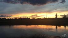
The sunset across the Bechler River was amazing! Just over ten miles for today, our farthest day of the trip. At 9B2, we had one adult that was able to make a phone call with his cell phone. I believe his provider was Verizon.
One Filter is Working… at 70%
Wednesday was one of our shortest distances of the trip at about 9.5 miles, up Bechler Canyon to four of the waterfalls in the Cascade Corner—Iris and Colonnade Falls, back down and over to Silver Scarf and Dunanda Falls. Campsites were 9A2 and 9A3. When we arrived at our campsite, I sat down and decided to tear into the hardware of my pump a little. Not the filter, but the mechanisms. I figured that it probably couldn't get any worse than it is. I ended up pulling off the bladder valves and trying to remove any sediment. That seemed to be what was causing most of my problems. The pleated filter had still become clogged, that's why I couldn't get to full capacity. At least we now had one working pump for 14 hikers. That's how it would remain for the rest of the trip.
The privy at 9A3 was the most scenic view I've ever had while taking care of business. It overlooked the Bechler Meadows and down to the Teton mountain range.
Down Through Bechler Meadows
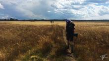
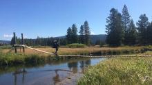
Thursday was straight down the middle of the Bechler Meadows and over the Boundary Creek footbridge before crossing our deepest and widest ford in the Bechler River and back east to 9U2 and 9U3 for the night. Some were struggling as they weren't taking in enough calories, especially the adult who was still unable to eat his dehydrated food. I had plenty of snacks that I shared with the adult just to try to give him as much nourishment as I could. He was getting weaker and weaker by the day.
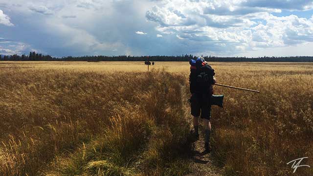
Some boys were guzzling water like it was in unlimited supply even though we were at less than half the capacity for water filtration as when we started. It took me well over an hour to pump more than 28 liters of water at each stop for water. 2+ liters per person and 14 hikers. Even before I could filter water for myself, some boys would come back asking for another refill of their water bladders or bottles. Cascade Corner through us for a few unexpected challenges. Luckily we were able to survive them and complete our trip with great satisfaction.
It was decided tonight that the adult that was struggling to eat food and another adult would hike back to the vehicles Friday morning and shuttle our vehicles into Camp Loll while the remaining 12 would hike into Loll via the Cascade Creek trailhead and past Tillery Lake. Two of the young men decided they were done and went with those adults. So, ten of us would finish the full 50 miles on Friday.
Cardiac Hill and Into Camp Loll
Friday was the shortest distance, but the most elevation gain of hiking for the trip as we hiked the Mountain Ash Creek Trail over Proposition Creek, up Cardiac Hill, and our last two river fords of the Falls River and Cascade Creek. It began raining when we were filtering water at Proposition Creek and stopped about the time we finished the mile-long climb. I had hoped to see one more of the Cascade Corner waterfalls on our final leg of the trip, but unfortunately most didn't want to take the two mile detour to Terraced Falls.
We planned on finishing our 50-miler at Camp Loll because our 12–13 year old young men were there all week while we did this hike. We traveled back home together Saturday morning.
Overall, I would say that despite a couple obstacles that could have easily ended the hike early, it was a success. I love hiking this area of Yellowstone and giving young men an appreciation of nature, and a sense of accomplishment of hard challenges.
Why Visit Cascade Corner?
Located in the southwest corner of Yellowstone, the Bechler region is home to nearly a hundred known waterfalls and cascades. And because many of the trailheads that give you access to this corner require travel on somewhat rough dirt roads, this is not a touristy area of the park, especially as most waterfalls require a full-day or at least a one night stay in one of the many backcountry campsites.

